|
Sonja Sonnenburg presented a wonderful lecture in 2014 at the Nason House at New Mexico State University titled "On The Move: Military Citizenry, Indigenous Spaces and the De La O Sisters of Nueva Viscaya and Nuevo Mexico" During this lecture she talked about the military stance on the indigenous spaces between the 1770s - 1800s. According to Sonja, the Spanish Authorities / Spanish Colonial Authorities believed that in the North of Mexico there was an indigenous space. 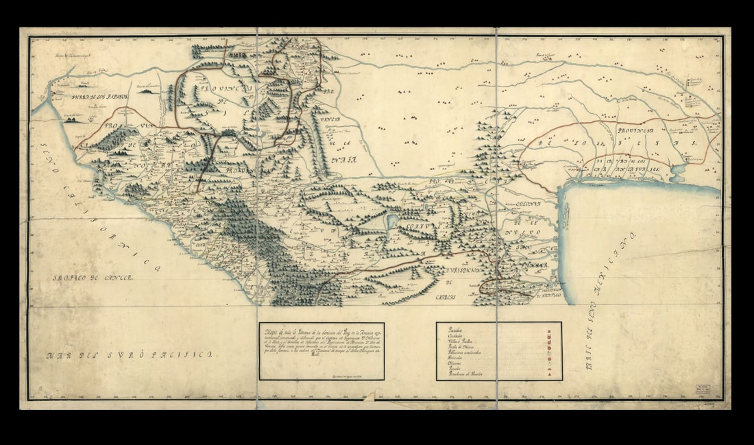 After a military surveillance approximately in 1771 a map, found in the Library of Congress, was established to identify the immense indigenous terrain. Along with this knowledge military defenses were revised accordingly with their belief in a line of defense against contentious intrusions. Thus Presidios were either eliminated or moved respectively causing families to either pick up and permanently relocate or move regularly. Soldiers that traveled continuously were part of the Compañías Volantes. The women of these Compania soldiers were also known as soldados. Thus it would not be astonishing to find a woman referred to as a soldado within a record. 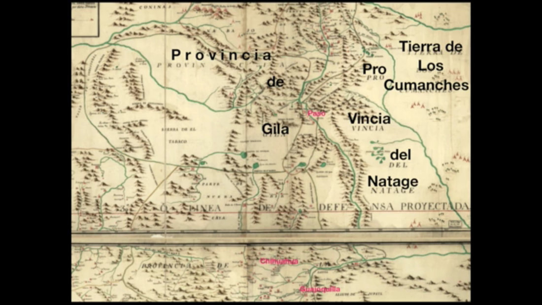 Within this indigenous space there was the Provencia de Comanches, cited in some circles as Comancheria, in the North and Northeastern territory of Paso del Norte. Today this territory resides in New Mexico, southeastern Colorado, southwestern Kansas, western Oklahoma, majority of northwest Texas and northern Chihuahua. Then to the South and Southeast territory of Paso del Norte was the Provencia de Natage, that was also referred to as Apaches and Mescaleros. The name Natage originated from a Mescalero band name, Nit'ahe, interpreted as "by the mountain's edge." Depending on the geographic territory the Mescalero Apaches were referred to by different names in documents: Apaches de Cuartelejo, Apaches del Río Grande, Apachi, Faraones, Mezcaleros, Natage (more correctly, one of the Lipan Apache subdivisions, along with the Nahizan), Natahene, Querechos, Teyas, Tularosa Apaches, and Vaqueros. Amid the northern or southern Mescalero territory they were esteemed as: Sierra Blanca Apaches, Sacramento Mountains Apaches, Guadalupe Mountains Apaches, Limpia Mountains Apaches. Finally, the third indigenous territory, west of Paso del Norte, was the Provencia de Gila, also distinguished as Apaches. Apaches in general were also referred to as Apacheria. North of the Provencia de Gila was the Provencia de Navejo and the Tierras de los Conimas and Tierras de los Uta. 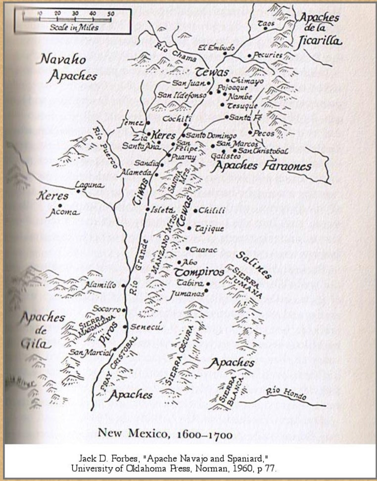 Sonja went on to present a satellite picture, in a modern framework, for a better understanding of the military viewpoint from their surveillance findings. This simultaneously allows genealogist of all levels that may have connections to the surrounding areas of Paso del Norte de Mexico, that also show Native American DNA or has a military connection, a capacity to narrow down the direction that one may need to look towards for records. 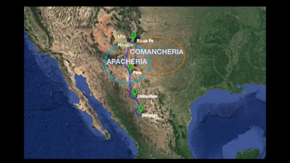
0 Comments
|
Penny Alvarez-KellerGraduated from Arkansas Tech University with a degree in Management / Marketing and a degree in Economics / Finance Archives
February 2023
Categories
All

|
Digging Up Deep Roots
 RSS Feed
